
Horse camping at Wildcat Campground, Point Reyes National Seashore
Horse camping facts for Wildcat Campground in Point Reyes National Seashore, from National Park Service: sites, rig length, trailer parking, horse trails nearby and the rules. Where an agency doesn't publish something, this page says so.
More horse camps, trailer parking, horse-legal trails and rules at Point Reyes: Point Reyes horseback riding.
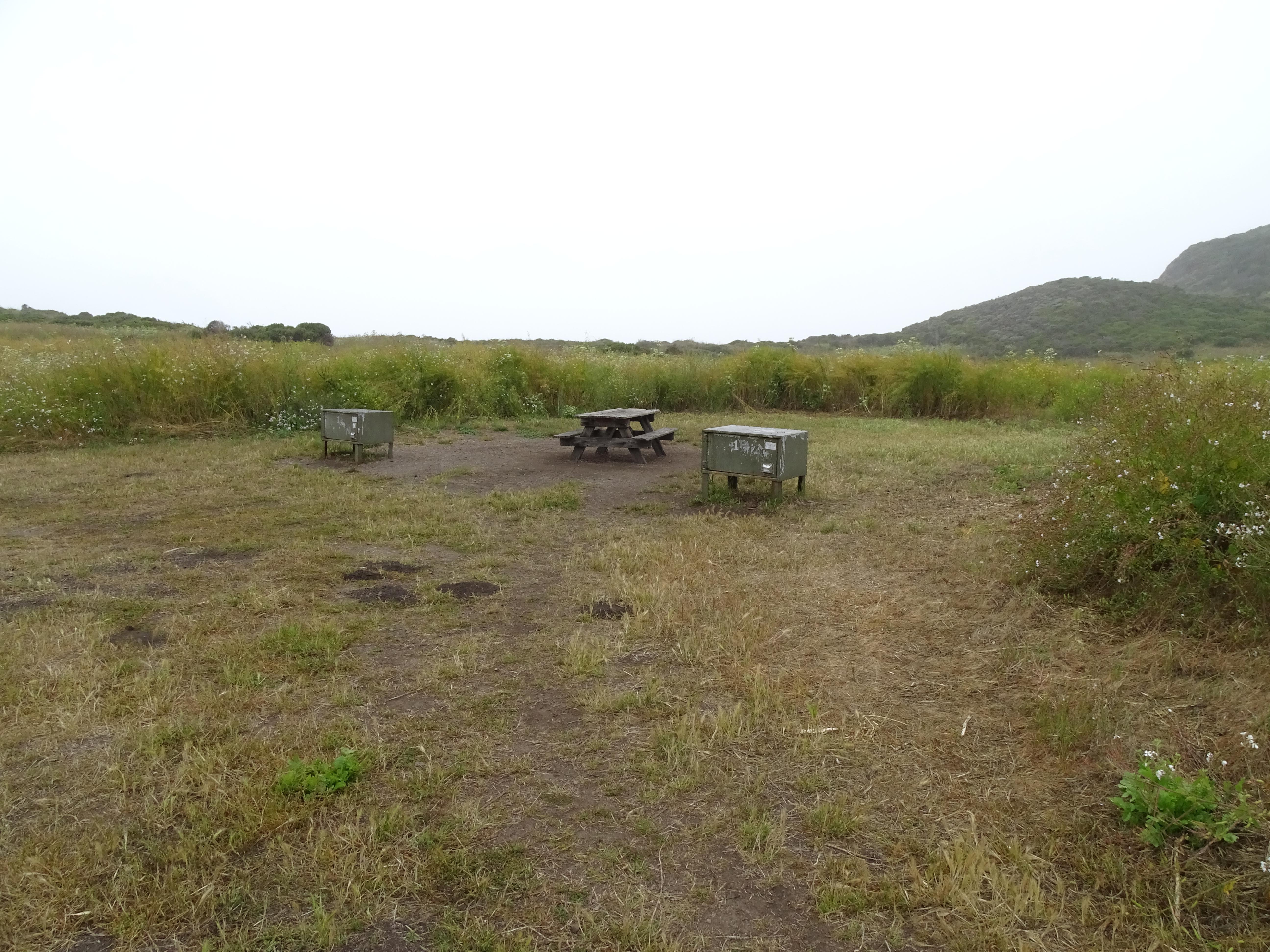
What are the horse camping facts at Wildcat Campground?
- Managed by
- National Park Service [1]
- Park or forest
- Point Reyes National Seashore [1]
- Listed for horses as
- Campsites open to horses [1] (National Park Service)
- Hitching posts
- Yes (“Pack animals and horses must be tied to hitch rails.”) [2]
- Not published
- Not published by the National Park Service: horse sites, max rig length, horses per site, corrals. Ridden here? Add it in Ride Bring a portable corral or a highline.
- Reservations
- Camping is by permit only. Camping permits must be obtained before starting your trip. [1] Full text from National Park Service Book
- Coordinates
- 37.97015, -122.79069 [1] · Directions [1]
Where do I park a horse trailer at Wildcat Campground?
Max rig length at the camp: Not published by the National Park Service. Ridden here? Add it in Ride
Lots where the National Park Service publishes oversize spaces:
Five Brooks Parking Lot
Randall Trailhead Roadside Parking
Bear Valley Bus/RV/Trailer Parking Lot
NPS "oversize" spaces are sized for buses, RVs and trailers alike, not reserved for horse trailers.
Nearest trailheads (trailer access unknown)
Palomarin Trailhead Parking Lot
McCurdy Trailhead Roadside Parking
Bear Valley Trailhead Parking Lot
Bear Valley Visitor Center Parking Lot
Commonweal Entrance Parking Lot
Bolinas Ridge Trailhead Roadside Parking
Cross Marin Trailhead Roadside Parking
Limantour Beach South Parking Lot
Which horse trails start near Wildcat Campground?
Bolinas Ridge Trail
Coast Trail
Pine Mountain Road
Stewart Trail
Bolinas Ridge Trail
San Geronimo Ridge Road
San Geronimo Ridge Fire Road
Kent Pump Road
Bear Valley Trail
Estero Trail
Stewart Trail
Bolinas-Fairfax Rd
Plus 136 more named horse-legal trails in the same data, not listed here.
Trails within about 9 miles where the managing agency (or OpenStreetMap) marks horses as allowed. Mileage is the mapped length of segments with that name, not a loop distance.
When is Wildcat Campground open?
- Season: The Wildcat Campground is open year-round, 24 hours a day. Camping is by permit only. [1] Full text from National Park Service
As of October 25, 2026. Check with the agency before you haul: seasons move with snow and fire.
What are the horse rules at Wildcat Campground?
- Visit our park's Backcountry Camping web page for more about the rules and regulations. Basic rules and regulations include: * Permits are required. * Camp in designated sites. * Dogs and/or other pets are prohibited. * Drones are prohibited. * Glass containers are prohibited within 50 feet of the beach. * Follow Leave No Trace principles. * Store your food and other scented items properly in the food storage lockers provided at the campsite. * Properly dispose of human waste. * Do not wash dishes, bathe, or wash clothing at water faucets. * Wood and charcoal fires are prohibited at the campsites. * Fireworks are prohibited. * Most types of weapons are prohibited. * Hunting is prohibited. * Quiet hours are from sundown to sunrise. * Campers must vacate their campsite by noon on their day of departure. Campsites should be left clean. [1] Full text from National Park Service Full rules
- Maximum number of horses or pack animals in any campground is eight [2]
- No horses on Saturdays, Sundays and holidays on the Bear Valley Trail between the Mt. Wittenberg and Glen junctions, the Meadow Trail or the Old Pine Trail. [5]
- Horses are never allowed on Drakes Beach, on the dunes or on interpretive trails. [5]
- Feed weed-free feed for a few days before your visit. [5]
- Don't unload manure or hay in the seashore. [5]
- Tie horses only to hitching rails. [5]
- Avoid wet, muddy trails. [5]
Is there water for horses at Wildcat Campground?
- Water for horses: Not published by the National Park Service. Ridden here? Add it in Ride
- Water hookup at the site: Not published by the National Park Service. Ridden here? Add it in Ride
- Drinking water (people): Yes - year round [1]
Ridden here?
Ride is a free iPhone app for logging rides, built for trail rides out of cell range: GPS keeps recording with no signal and the ride syncs later. If an agency hasn't published something on this page and you know it, add it in Ride.
 Free · iPhone · iOS 16.4+
What other horse campgrounds are near Wildcat Campground?
Packing for it: the horse camping checklist.
Sources
- National Park Service: https://www.nps.gov/pore/planyourvisit/wildcat-campground.htm, fetched October 16, 2026
- National Park Service: https://www.nps.gov/pore/planyourvisit/camping.htm, read and verified by hand October 24, 2026
- National Park Service: https://www.nps.gov/pore/planyourvisit/directions.htm, fetched October 16, 2026
- National Park Service: https://www.nps.gov/pore/planyourvisit/parking-lots.htm
- National Park Service: https://www.nps.gov/thingstodo/horse-riding-in-point-reyes-national-seashore.htm
- National Park Service: https://mapservices.nps.gov/arcgis/rest/services/NationalDatasets/NPS_Public_Trails/MapServer/0/query?where=OBJECTID%3D15466&outFields=*&f=html
- National Park Service: https://mapservices.nps.gov/arcgis/rest/services/NationalDatasets/NPS_Public_Trails/MapServer/0/query?where=OBJECTID%3D16263&outFields=*&f=html
- County of Marin: https://services6.arcgis.com/T8eS7sop5hLmgRRH/arcgis/rest/services/Trails_MarinCounty_Symbology_2024/FeatureServer/3/query?where=FID%3D1044&outFields=*&f=html
- National Park Service: https://mapservices.nps.gov/arcgis/rest/services/NationalDatasets/NPS_Public_Trails/MapServer/0/query?where=OBJECTID%3D16050&outFields=*&f=html
- County of Marin: https://services6.arcgis.com/T8eS7sop5hLmgRRH/arcgis/rest/services/Trails_MarinCounty_Symbology_2024/FeatureServer/3/query?where=FID%3D416&outFields=*&f=html
- County of Marin: https://services6.arcgis.com/T8eS7sop5hLmgRRH/arcgis/rest/services/Trails_MarinCounty_Symbology_2024/FeatureServer/3/query?where=FID%3D1003&outFields=*&f=html
- County of Marin: https://services6.arcgis.com/T8eS7sop5hLmgRRH/arcgis/rest/services/Trails_MarinCounty_Symbology_2024/FeatureServer/3/query?where=FID%3D1307&outFields=*&f=html
- County of Marin: https://services6.arcgis.com/T8eS7sop5hLmgRRH/arcgis/rest/services/Trails_MarinCounty_Symbology_2024/FeatureServer/3/query?where=FID%3D1008&outFields=*&f=html
- National Park Service: https://mapservices.nps.gov/arcgis/rest/services/NationalDatasets/NPS_Public_Trails/MapServer/0/query?where=OBJECTID%3D14845&outFields=*&f=html
- OpenStreetMap contributors: https://www.openstreetmap.org/way/1507995404
- OpenStreetMap contributors: https://www.openstreetmap.org/way/28917684
- California State Parks: https://services2.arcgis.com/AhxrK3F6WM8ECvDi/arcgis/rest/services/RecreationalRoutes/FeatureServer/0/query?where=FID%3D1059783&outFields=*&f=html