
Horse camping at Wawona Horse Camp, Yosemite National Park
Horse camping facts for Wawona Horse Camp in Yosemite National Park, from National Park Service, Recreation.gov: sites, rig length, trailer parking, horse trails nearby and the rules. Where an agency doesn't publish something, this page says so.
More horse camps, trailer parking, horse-legal trails and rules in Yosemite: Yosemite horseback riding.
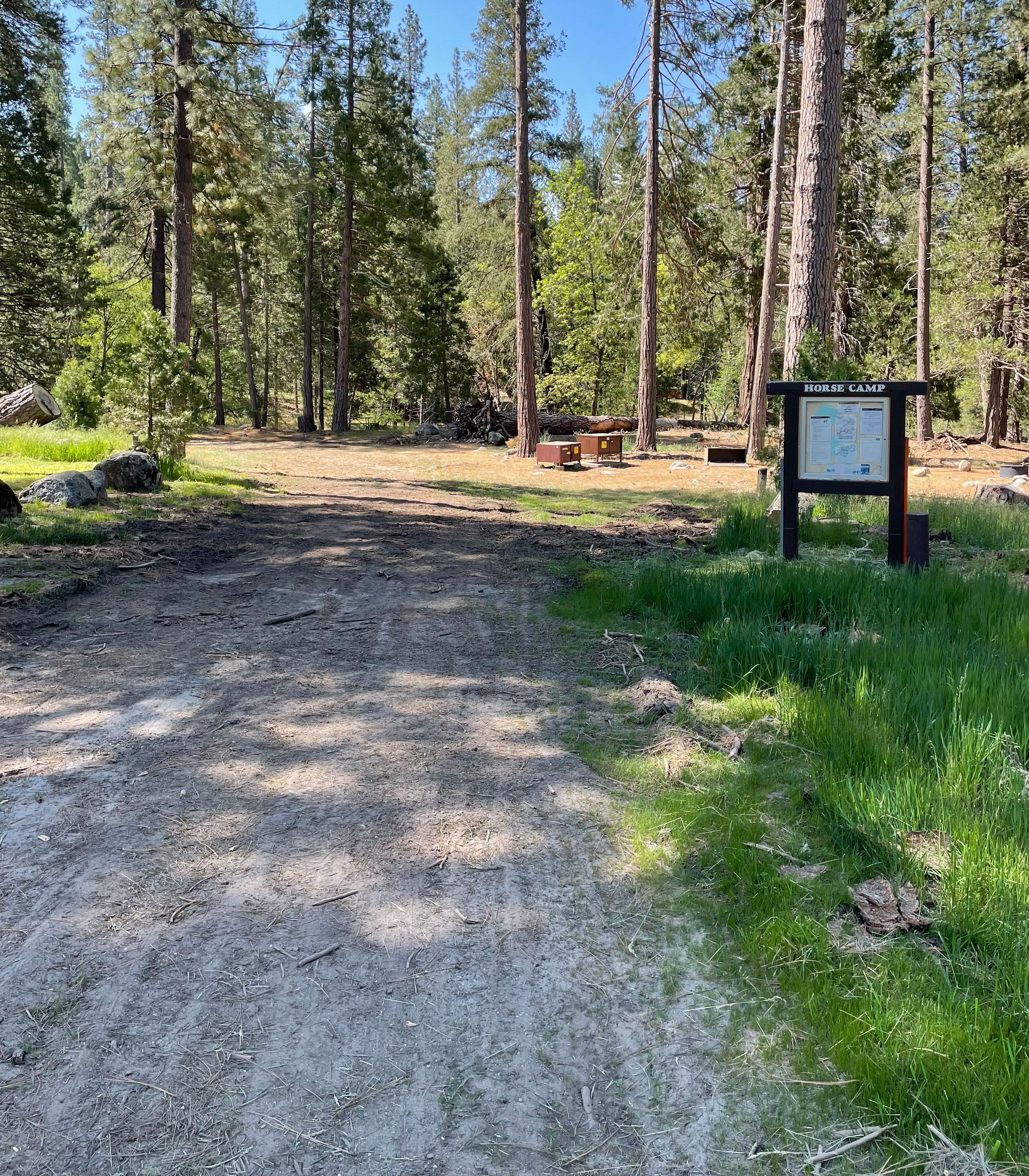
What are the horse camping facts at Wawona Horse Camp?
- Managed by
- National Park Service [1]
- Park or forest
- Yosemite National Park [1]
- Listed for horses as
- Campsites open to horses [1] (National Park Service)
- Horse sites
- 2 [2]
- Max rig length
- 35 ft [1]
- Horses per site
- 6 [2]
- Not published
- Not published by the National Park Service or Recreation.gov: corrals, hitching posts. Ridden here? Add it in Ride Bring a portable corral or a highline.
- Reservations
- Wawona Horse Camp reservations are required from early May through early to mid-October. During the rest of the year the campground is closed. [1] Full text from National Park Service Book
- Coordinates
- 37.53952, -119.65243 [1] · Directions [1]
Where do I park a horse trailer at Wawona Horse Camp?
Max rig length at the camp: 35 ft [1]
Stock-trailer parking in Yosemite: Frontcountry stock sites at Wawona (2), Bridalveil Creek (3) and Tuolumne Meadows (4) campgrounds, with a limit of two vehicles and two stock trailers per parking area. Stock can be loaded and unloaded at any stock camp, designated stock area or concession stable. [3]
Nearest trailheads (trailer access unknown)
Mariposa Grove Welcome Plaza
Alder Creek Trailhead
Wawona Point Trailhead
Yosemite History Center (Forest Drive)
Wawona Store and Post Office
Meadow Loop Trailhead
Chilnualna Falls Horse Trailhead
Chilnualna Falls Trailhead
Which horse trails start near Wawona Horse Camp?
South Fork Merced
Alder Creek Trail
Ostrander Lake Trail
Virginia/granite Creek
Perimeter Trail
Chilnualna Falls Trail
Chilnualna Falls Trail
Wawona Meadow Loop Trail
Iron Creek
Rush Creek
Old Glacier Point Road
Star Lakes
Plus 19 more named horse-legal trails in the same data, not listed here.
Trails within about 9 miles where the managing agency (or OpenStreetMap) marks horses as allowed. Mileage is the mapped length of segments with that name, not a loop distance.
When is Wawona Horse Camp open?
- Season: Wawona Horse Camp reservations are required from early to mid-April through early to mid-October. During the rest of the year the campground is closed. [1] Full text from National Park Service
- Seasonal Winter Closure: October 12, 2026 to May 1, 2027 [1]
As of October 25, 2026. Check with the agency before you haul: seasons move with snow and fire.
What are the horse rules at Wawona Horse Camp?
- Pets: Permitted; must be on a leash at all times. Fires: Wood and charcoal fires are permitted. People per site: A maximum of six people and six head of stock are allowed per campsite, Vehicles per site: A maximum of two vehicles and two stock trailers are allowed per campsite. [1] Full text from National Park Service Full rules
- "Except where otherwise posted or listed below, all designated trails in the park are open to stock use." Valley-floor stock trails are signed as bridle paths. [3]
- Closed to stock: bicycle paths, tram roads, shuttle routes; Mist Trail (Happy Isles to Nevada Fall), Snow Creek Trail from Mirror Lake, Mirror Lake Road; Lower Chilnualna Falls; Mariposa Grove except Perimeter Trail; Gaylor Lakes; Muir Gorge segment. [3]
- "Maximum of 25 head of pack and saddle stock per party." Overnight on non-maintained routes: 12 stock and 8 people. [3]
- "Cross-country or off-trail travel with stock is prohibited." Stock parties travel single file when possible. [3]
- "Grazing is permitted except within four miles of trailheads and paved roads or immediately surrounding any of the High Sierra Camps." [3]
- "Stock must be picketed at least 100 feet from any stream, lake, or spring." No tying to trees beyond loading and unloading. [3]
- Wilderness stock users must carry a shovel and rake to naturalize camps and scatter manure. [3]
- Llamas are not allowed on the High Sierra Camp Loop, the Vernal/Nevada Falls corridor, or the river trail from Nevada Fall to Merced Lake. [3]
- Private stock may stay overnight only in campgrounds with designated stock sites; reservations required; no stock camp in Yosemite Valley. [3]
- At stock camps: "Feed must be provided. Grazing is prohibited. The use of weed-free stock feed is required." Use hitch lines or portable corrals; wrap trees under ropes. [3]
- Several wilderness stock camps are closed, including Benson Lake, Crescent Lake, Hook Lake, Isberg Lake, Miller Lake, Rodgers Lake, Turner Meadow and Virginia Canyon-Castle Camp. [3]
Is there water for horses at Wawona Horse Camp?
- Water for horses: Not published by the National Park Service or Recreation.gov. Ridden here? Add it in Ride
- Water hookup at the site: Not published by the National Park Service or Recreation.gov. Ridden here? Add it in Ride
- Drinking water (people): Yes - seasonal [1]
Ridden here?
Ride is a free iPhone app for logging rides, built for trail rides out of cell range: GPS keeps recording with no signal and the ride syncs later. If an agency hasn't published something on this page and you know it, add it in Ride.
 Free · iPhone · iOS 16.4+
What other horse campgrounds are near Wawona Horse Camp?
Packing for it: the horse camping checklist.
Sources
- National Park Service: https://www.nps.gov/yose/planyourvisit/wawonahorsecamp.htm, fetched October 16, 2026
- Recreation.gov: https://www.recreation.gov/camping/campgrounds/10220609, fetched October 25, 2026
- National Park Service: https://www.nps.gov/yose/planyourvisit/stock.htm, read and verified by hand October 24, 2026
- National Park Service: https://www.nps.gov/yose/planyourvisit/directions.htm, fetched October 16, 2026
- OpenStreetMap contributors: https://www.openstreetmap.org/node/10883959311, fetched October 25, 2026
- OpenStreetMap contributors: https://www.openstreetmap.org/node/1755672016, fetched October 25, 2026
- OpenStreetMap contributors: https://www.openstreetmap.org/node/89223651, fetched October 25, 2026
- OpenStreetMap contributors: https://www.openstreetmap.org/node/4022795213, fetched October 25, 2026
- OpenStreetMap contributors: https://www.openstreetmap.org/node/11163374899, fetched October 25, 2026
- USDA Forest Service: https://apps.fs.usda.gov/arcx/rest/services/EDW/EDW_TrailNFSPublish_01/MapServer/0/query?where=objectid%3D10558243&outFields=*&f=html
- OpenStreetMap contributors: https://www.openstreetmap.org/way/203834185
- OpenStreetMap contributors: https://www.openstreetmap.org/way/1193603702
- USDA Forest Service: https://apps.fs.usda.gov/arcx/rest/services/EDW/EDW_TrailNFSPublish_01/MapServer/0/query?where=objectid%3D10566772&outFields=*&f=html
- National Park Service: https://mapservices.nps.gov/arcgis/rest/services/NationalDatasets/NPS_Public_Trails/MapServer/0/query?where=OBJECTID%3D14929&outFields=*&f=html
- OpenStreetMap contributors: https://www.openstreetmap.org/way/163901701
- National Park Service: https://mapservices.nps.gov/arcgis/rest/services/NationalDatasets/NPS_Public_Trails/MapServer/0/query?where=OBJECTID%3D21503&outFields=*&f=html
- National Park Service: https://mapservices.nps.gov/arcgis/rest/services/NationalDatasets/NPS_Public_Trails/MapServer/0/query?where=OBJECTID%3D16611&outFields=*&f=html
- USDA Forest Service: https://apps.fs.usda.gov/arcx/rest/services/EDW/EDW_TrailNFSPublish_01/MapServer/0/query?where=objectid%3D10573925&outFields=*&f=html
- USDA Forest Service: https://apps.fs.usda.gov/arcx/rest/services/EDW/EDW_TrailNFSPublish_01/MapServer/0/query?where=objectid%3D10579927&outFields=*&f=html
- OpenStreetMap contributors: https://www.openstreetmap.org/way/851124594
- USDA Forest Service: https://apps.fs.usda.gov/arcx/rest/services/EDW/EDW_TrailNFSPublish_01/MapServer/0/query?where=objectid%3D10559458&outFields=*&f=html